![]()
Arunachal has become full-fledged State on February 20, 1987. Till 1972, it was known as the North- East Frontier Agency (NEFA) . It gained the Union Territory status on January 20, 1972 and renamed as Arunachal Pradesh.
On August 15, 1975 an elected Legislative Assembly was constituted and the first council of Ministers assumed office. The first general election to the Assembly was held in February 1978.
Administratively, the State is divided into sixteen districts. Capital of the State is Itanagar in Papumpare district. Itanagar is named after Ita fort meaning fort of bricks, build in the 14th century AD.
Arunachal Pradesh find mentioned in the literature of Kalika Purana and Mahabharta. This place is the Prabhu Mountains of Puranas. It was here the sage Parashuram atoned of his sin, sage Vyasa meditated, King Bhismaka founded his kingdom and Lord Krishna married his Consort Rukmini.
The widely scattered archeological remains at different places in Arunachal Pradesh bear testimony to its rich culture and heritage.
![]()
Arunachal Pradesh, situated in the north eastern part of India is nearly 84,000 sq km in area and has a long international border with Bhutan to the west (160km), Tibet to the north and north-east (1,080 km) and Myanmar to the east (440km). It stretches from snow-capped mountains in the north to the plains of Brahmaputra valley in the south. Arunachal is the largest state area wise in the north-eastern region, even larger than Assam which is the most populous.
It is a land of lush green forests, deep river valleys and beautiful plateaus. The land is mostly mountainous with Himalayan ranges along the northern borders criss-crossed with mountain ranges running north-south. These divide the state into five river valleys: the Kameng, the Subansiri, the Siang, the Lohit and the Tirap. All these rivers are fed by snows from the Himalayas and countless rivers and rivulets except Tirap which is fed by Patkai Range.
The mightiest of these river is Siang, called Tsangpo in Tibet, which becomes Brahmaputra after it is joined by the Dibang and the Lohit in the plains of Assam.
High mountains and dense forests have prevented intercommunication between tribes living in different river valleys. The geographical isolation thus imposed has led different tribes to elove their own dialects and grow with their distinct identities. Nature has endowed the Arunachal people with a deep sense of beauty which finds delightful expression in their songs, dances and crafts.
The climates varies from hot and humid in the Shivalik range with heavy rainfall. It becomes Progressively Cold as one moves northwards to higher altitudes.
Trees of great size, plentiful climbers and abundance of cane and bamboo make Arunachal evergreen. Tropical rain forests are to be found in the foothills and hills in the east on the border with Myanmar. Northern most border is covered with Alpine forests. Amidst the highly rugged terrain, there are green forests and plateaus.
![]()
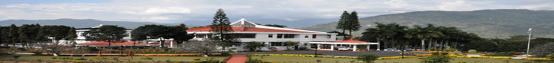
ITANAGAR, located at an altitude of 530 meters above sea level between 93 east longitude and 27 north latitude. It was built more then three decades ago.
The population of Arunachal is 13,82,611 according to 2011 census and is scattered over 26 towns and 3863 villages.
Most of the tribes inhibiting the land are ethnically similar, having derived from original common stock but their geographical isolation from each other has brought amongst them certain distinctive characteristics in language, dress and customs.